Tibet Tourism

-
Province:Tibet (Chinese: 西藏, Pinyin: Xī Zàng)
-
Population :2,840,000
-
Area :1,228,400 square km (474,300 square mile)
-
Overview:With an average elevation of 4,900 metres (16,000 ft), Tibet has long been a favored destination for tourists from around the world.
Overview
Tibet, the Land of Snows, the roof of the world: For centuries the mysterious Buddhist kindom of Tibet, locked away in its mountain fastness of the Himalaya,has exercised a unique hold on the imagination of the west. For adventurers and traders it was a land of treasure and riches. Those on a spiritual quest whispered of a lost and steeped in magic and mystery.
Tibet is without doubt one of the most remarkable places to visit in Asia. It offers fabulous monastery sights, breathtaking high-altitude trekes, stunning views of the world's highest mountains and one of the most likeable people you will ever meet.
Know more
Location
Locked in by towering mountains, Tibet on the southwestern border lies in the main part of the Qinghai-Tibet Plateau, the highest in the world, at an average altitude of 4,000 meters. Set up as an autonomous region in 1965, it has an area of more than 1.2 million square kilometers.
Topography
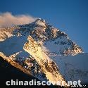
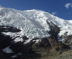
The Himalayas in the south of Tibet have an average of 6,000 meters, the highest range on the earth. Their main peak, 8,848-metre Mount Qomolangma on the Sino-Nepalese border, is the summit of the globe. In the north are the Kunlun range and its branch, the Tanggula Mountains; in the middle the Gangdise range; and in the east the Hengduan range with numerous canyons and imposing mountains.
North of the Gangdise range and south of the Kunlun range is the vast Northern Tibet Plateau. The Southern Tibet Valleys between the Gangdise and the Himalayas, crossed by the Yarlungzangbo River from west to east, are the principal farming and pastoral area of Tibet.
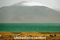
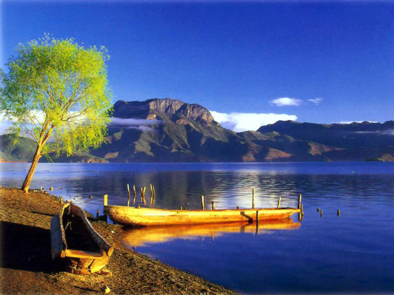
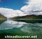
Tibets major rivers include the Yarlungzangbo, Nujiang, Lancang and Jinsha. The Tibet Plateau, one of the regions in China with the greatest number of lakes, has numerous salt lakes, the largest being Nam Co. In all, lakes cover a total area of some 30,000 square kilometers on the plateau. Tibet ranks second in the country in hydroelectric power potentials.
Population
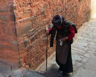
Set up as an autonomous region in 1965, Tibet has a population of 1.85 million, of which 15 per cent live in the cities and 85 per cent in the rural areas and 1.65 million are Tibetans, the predominant nationality there, and the rest Huis, Moinbas, Lhobas and Hans.
Must see
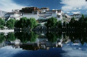
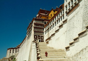
As the capital of Tibet, over 1,300 years old, Lhasa dates back to the 7th century A.D when the colorful Tibetan figure, Songtsen Gampo, built his palace in Lhasa. In 1642, the 5th Dalai Lama also made Lhasa his capital and rebuilt teh architectural wonder, the Potala Palace, religion which is blended into every aspect of life further define Lhasa's culture...more
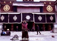
Around 250km to the south-west of Lhasa, Shigatse is the second-largest city in Tibet. Since the Mongol sponsorship of the Gelugpa order, Shigatse has been the seat of the Panchen Lama, who is traditionally based in Tashihunpo Monastery, which is one of the high-lights of Tibet and is Shigatse's foremost attraction...more
Situated in the northwest Yunnan Hengduan Mountains on the southern Qinghai-Tibet Plateau, the Shangri-La Scenic Region consists of Diqing Prefecture, Nujiang Prefecture, and some area of Lijiang and Dali Prefectures, covers a total area of over 3,500 square kilometers. It is the one of the largest and the most promising scenic region in China...more
Gyantse (3950m) is in the Nyang Chu valley, 254km south-west of Lhasa, is a tipical small Tibetan town. It is one of the few places where the mordernazation has not changed much. It is easy to spend a couple of days in Gyantse. There, the BBC Four documentary "A Year in Tibet" focused on the lives of ordinary Tibetans ...more
Nagri, the western region of Tibet, is one of the most remote and inaccessible part of China. Trip to Nagri is marked by stunning, scenery, and sacred Mt. Kailash and Lake Manasarovar are two of the most remote and legendary travel destinations in the world. Other worldly ruins are the ancient Guge Kindom and Nagri's prehistoric rock carvings near Putok. ...more